Narrated audio driving tour
Red Rock Canyon Scenic Drive
Nevada, USA
- Stories on the way
- 14
- Distance
- 28 mi
- Drive time
- 1 hr 35 min
Hear the narrator
One real story from this drive, in the voice that rides along — the same one your car hears when you reach the spot.
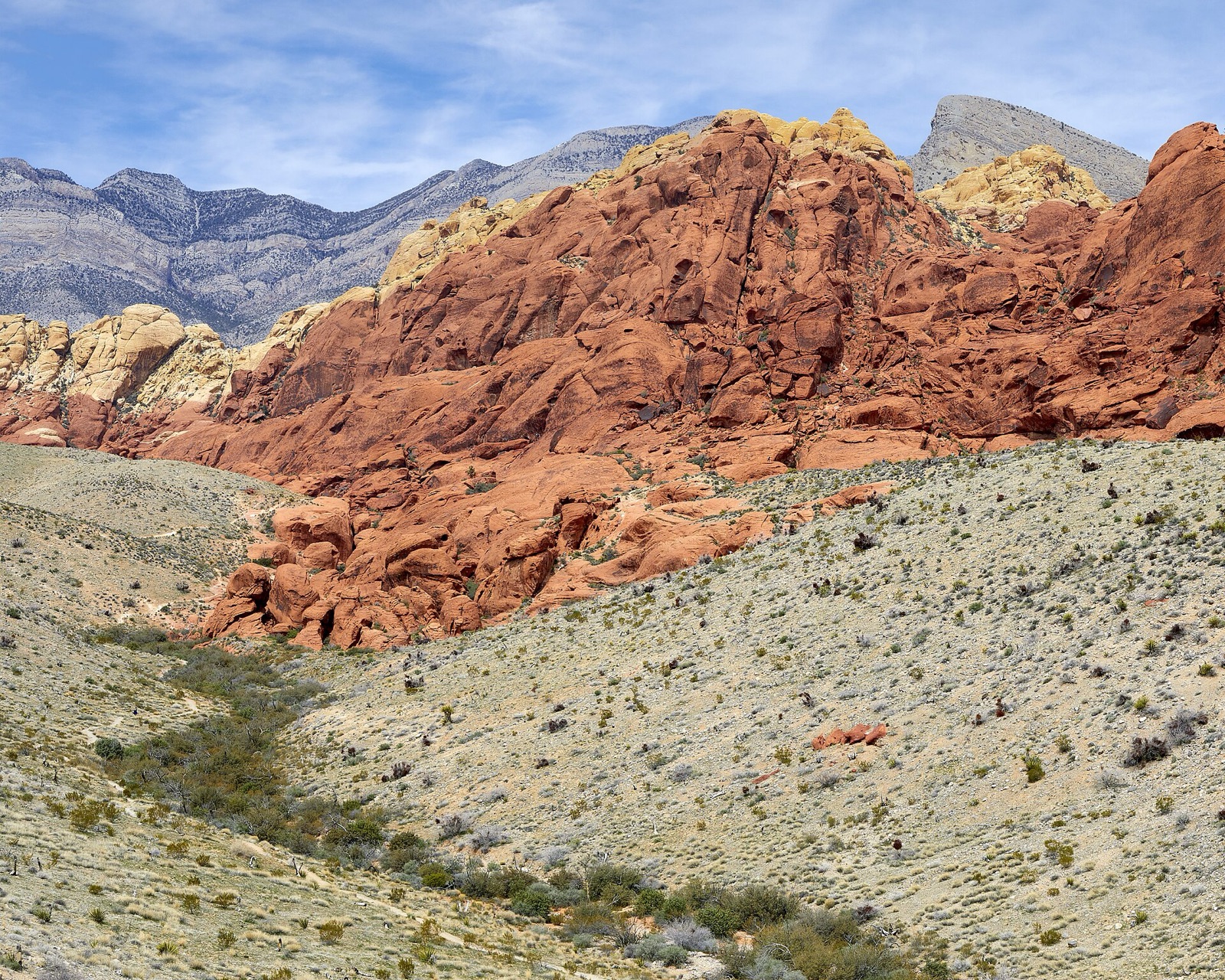
The Calico Hills
0:00 / 0:30
Red Rock Canyon Scenic Drive is a narrated audio driving tour through Nevada, USA — about 1 hour 35 minutes and 28 miles end to end. The route strings together 14 stops — The Las Vegas Valley, Red Rock Canyon Visitor Center and Spring Mountain Ranch State Park among them — each with a story that plays automatically as you reach it. Download the drive in Getaways and it rides along offline, narrating the road even where the signal drops.
Every stop on the route
14 places, 14 stories — each one starting itself as you arrive. Here's what you'll pass; the narration rides along in the app.
- 1
The Las Vegas Valley
More on Wikipedia - 2
Summerlin
More on Wikipedia - 3
Red Rock Canyon Visitor Center
More on Wikipedia - 4
The Calico Hills
More on Wikipedia - 5
Sandstone Quarry
- 6
The Keystone Thrust
More on Wikipedia - 7
High Point Overlook
More on Wikipedia - 8
Willow Springs
More on Wikipedia - 9
Ice Box Canyon
- 10
Pine Creek Canyon
More on Wikipedia - 11
The Wilson Cliffs
More on Wikipedia - 12
Spring Mountain Ranch State Park
More on Wikipedia - 13
Bonnie Springs
More on Wikipedia - 14
Blue Diamond
More on Wikipedia
Good to know before you go
The Las Vegas Valley
Fill the tank and fill your water bottles here in Summerlin. There is no fuel and no store on the loop, and the desert takes water out of you faster than it feels like it should.
Summerlin
If you are going to want a picnic later, buy it here. Spring Mountain Ranch has lawns and shade at the far end of the drive and nothing at all to buy.
Red Rock Canyon Visitor Center
A large paved lot wraps the visitor center, with accessible spaces close to the doors. It fills on winter weekends by mid-morning, and the overflow rows are a long walk in full sun.
The Calico Hills
Two small pull-offs, Calico Vista One and Two, both signed and both short. If the first is full, take the second — the view differs by about a hundred metres of frontage.
Sandstone Quarry
A big gravel lot, one of the largest on the loop, and still the first to fill on a cool Saturday. Vault toilets at the far end.
The Keystone Thrust
The White Rock and Willow Springs pull-offs along this stretch are the practical places to stop and study the contact line. All are short gravel bays off a one-way road.
High Point Overlook
A wide paved pull-off with room to turn a large vehicle, and the best sightlines on the loop for the least effort. Accessible from the car without walking.
Willow Springs
A short spur road leaves the loop for the picnic area and the parking is limited and shaded, which makes it the most contested lot on the drive at lunchtime.
Ice Box Canyon
A modest pull-off with vault toilets, and one that overflows onto the shoulder on cool weekends. The trailhead is at the far end of the lot.
Pine Creek Canyon
A large lot set back from the loop road with vault toilets, and the last substantial trailhead before the drive drops back down to the highway.
The Wilson Cliffs
The Red Rock Overlook pull-off on this last descent is paved, level and easy to enter, and it lines the cliffs up better than anywhere on the highway below.
Spring Mountain Ranch State Park
A paved lot by the ranch house with accessible spaces and shade at the edges. Easy turning room for anything you are likely to have rented.
Bonnie Springs
If you want the closest thing that still exists to what Bonnie Springs was, it is back at Spring Mountain Ranch — same springs, same cliffs, still open to the public.
Blue Diamond
Park on the street by the mercantile. It is a residential village, so use the marked spaces and keep driveways clear.
Take Red Rock Canyon Scenic Drive with you.
Download it once and someone in the car knows things the whole way — narration, map and stops, offline, so it keeps talking where the signal drops. Getting there is the getaway.
Plan this with friends
Every friendship dies the same death: the group chat. Start a trip instead — send one link, and everyone votes on the day and sees the same schedule, from the thread, on any phone, with nothing to install. When the weekend lands, this drive is already loaded, and every car of the caravan hears the same narrator.
Start a getaway in the app →